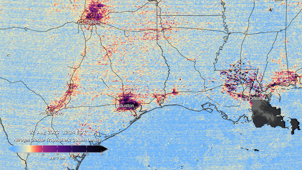
NASA has released the first data maps from a new instrument monitoring air pollution from space. The visualizations show high levels of major pollutants like nitrogen dioxide — a reactive chemical usually produced when fossil fuels are burned for transportation, power generation and other industrial activities, as well as wildfires — in the atmosphere over parts of North America.
Those images , which NASA compiled into a time lapse video and published on Thursday, pinpointed several urban areas in the United States, Canada, Mexico and the Caribbean as hotspots for air pollution, particularly during certain times of day. The pollution […]
Click here to visit source. www.cbsnews.com
See also Israel-Palestine War: United States Sends Hostage Rescue Experts To Assist Israeli Forces In Gaza
Powered by Inline Related Posts